Mahalapye
Mahalapye is a town located in the Central District of Botswana. The town has about 41,000 inhabitants and is situated along the main road between the capital Gaborone and the second largest city Francistown. Mahalapye has a bus station, a railway station, a couple of hotels and a market area with many shops and fast food restaurants, Water Shed mall is the latest attraction to those travelling from Gaborone to Francistown, great place for refreshments. It also has several petrol stations, some open 24 hours per day. Being situated on the edge of the Kalahari desert it is quite dry, and the local waterways are dry except during the rainy season. In recent times, it has become a convenient stop-over town for travelers travelling to and from Gaborone.
This town is located on the Tropic of Capricorn. Thus at approximately 13:11 hours on 21 December, or at solar noon on Summer Solstice, the sun will be directly overhead at this site. To mark this geographic feature there is a small monument just outside town on the 23rd parallel, or 23 degrees South of the equator. At this time the sun will be directly above this monument where the sun reaches its furthest point South. At this point there will be no shadow on the monument. The record high temperature ever registered in Mahalapye was 40.6 °C. The lowest temperature registered in Mahalapye was -6.0 °C.
The Botswana Prison Service (BPS) operates the Mahalapye Prison.
Actor, writer and playwright Donald Molosi was born in Mahalapye in 1985.
Politician, lawyer and jurist Duma Gideon Boko was born in Mahalapye on March 6, 1969.
Politician, communist Dr Gaobamong Kenneth Shololo Koma was born in Mahalapye on the 27 July 1923.
Map - Mahalapye
Map
Country - Botswana
 |
|
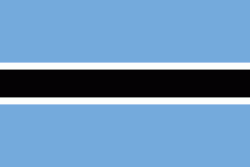
| Flag of Botswana | |
A country of slightly over 2.3 million people, Botswana is one of the most sparsely populated countries in the world. About 11.6 percent of the population lives in the capital and largest city, Gaborone. Formerly one of the world's poorest countries—with a GDP per capita of about US$70 per year in the late 1960s—it has since transformed itself into an upper-middle-income country, with one of the world's fastest-growing economies.
Currency / Language
| ISO | Currency | Symbol | Significant figures |
|---|---|---|---|
| BWP | Botswana pula | P | 2 |
| ISO | Language |
|---|---|
| EN | English language |
| TN | Tswana language |


